 |
| Exploring Indiana's Historic Sites, Markers & Museums - South Central Edition |
The Lost River in Orange County constitutes one of Indiana's most unusual geologic features. The river dives underground, pursuing its course through a subterranean system of channels as it courses its way to its rendezvous with the East Fork of the White River south of Shoals, Indiana
The Lost River
Length - About 87 Miles
The Lost River is a large sinkhole and subterranean stream, and an intricate cave system. There are two forks of the Lost River. The North Fork begins southwest of the intersection of North Smedley Road and West Ben Walton Road. The South Fork of the Lost River begins about 1.5 miles south just west of North Smedley Road in Washington County. The North and South Forks of the Lost River meet about three miles west of their sources. The junction is somewhat less than a mile east of Claysville, IN, just south of Lost River Road in Washington County. On its way, west the Lost River crosses Washington, Orange and Martin Counties. For about 23 miles of this length, mostly in Orange County, the Lost River flows underground, hence its name. Many of the features are on county roads that are not hard to find. The uniqueness of the Lost River makes is worthwhile to find them. The main features include the Wesley Chapel Gulf and the Orangeville Rise.
Wesley Chapel Gulf
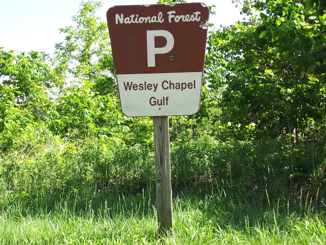
Wesley Chapel Gulf is a 187-acre tract of land located on the Hoosier National Forest in western Orange County, Indiana. It is named for the Wesley Chapel Church, located just to the north. Visitors will find Wesley Chapel Gulf about four miles southwest of Orleans and two miles east of Orangeville. To find, drive south from Orleans on Indiana State Road 37 to County Road 490 N, about 2.4 miles. A sign pointing towards Orangeville marks the road. Drive west on CR 490 (CR 500 at some point) for about 3.6 miles, reaching County Road 350 W. The Wesley Chapel Church marks the intersection. The church was built in 1858, originally known as Bruner's Chapel, and has an associated cemetery. The Gulf derives its name from the church. Turn left (south). The parking lot for the Wesley Chapel Gulf is about one half mile south of the church. A Hoosier National Forest sign indicates the correct spot to park. A short hiking trail leads to the Wesley Chapel Rise.
Wesley Chapel Gulf received designation as a National Natural Landmark in 1972 due to its impressive geologic features. The gulf provides a rare glimpse of the Lost River on its subterranean path. Several other karst features are represented in the immediate area of the Gulf including swallow holes, sinkholes, and caves. The Forest Service recognized the uniqueness of Wesley Chapel Gulf and acquired the property in 1996 through a land exchange with U.S. Gypsum Co. The best time to visit Wesley Chapel Gulf is in the fall after the foliage has died down, or during the winter months.
Orangeville Rise
From Wesley Chapel Gulf, return to County Road 500 N and turn left (west). County Road 500 N becomes first CR 525 N, then CR 540 N before intersecting County Road 500W. Turn left (south) towards Orangeville. The parking area is on the south side of Orangeville. A short trail leads to the Rise.
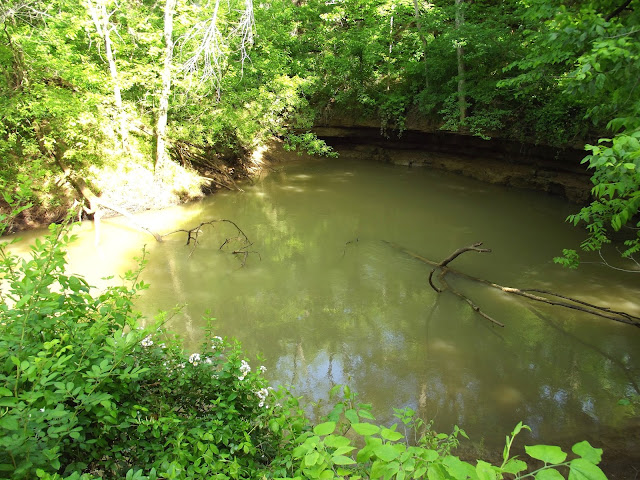
At the Orangeville Rise Indiana's second largest spring comes to the surface, forming streams that intersect with the Lost River a short distance away. The Rise is a tributary of the Lost River that rises from a cave into a 220-foot diameter rock-walled pit. The stream formed flows southwest to merge with the Lost River. The 355 square mile watershed of the Lost River covers five counties. This area possesses a large number of underground caves, sinkholes and underground streams.
The Indiana Karst Conservancy owns the three-acre area.
Tours
Forest service personnel conduct tours from time to time. For information, contact:
Visit French Lick West Baden
8102 West State Road 56
West Baden IN 47469
866.309.9139
Tour on your Own
Visitors may tour on their own at any time. For more information, contact:
Wesley Chapel Gulf
Hoosier National Forest
Indiana Karst Conservancy.
PO Box 2401,
Indianapolis, IN 46206-2401.
Division of Nature Preserves.
402 W. Washington St., Rm. W267.
Indianapolis, IN 46204.
317-232-0209.
The Lost River
Length - About 87 Miles
The Lost River is a large sinkhole and subterranean stream, and an intricate cave system. There are two forks of the Lost River. The North Fork begins southwest of the intersection of North Smedley Road and West Ben Walton Road. The South Fork of the Lost River begins about 1.5 miles south just west of North Smedley Road in Washington County. The North and South Forks of the Lost River meet about three miles west of their sources. The junction is somewhat less than a mile east of Claysville, IN, just south of Lost River Road in Washington County. On its way, west the Lost River crosses Washington, Orange and Martin Counties. For about 23 miles of this length, mostly in Orange County, the Lost River flows underground, hence its name. Many of the features are on county roads that are not hard to find. The uniqueness of the Lost River makes is worthwhile to find them. The main features include the Wesley Chapel Gulf and the Orangeville Rise.
Wesley Chapel Gulf
 |
| Wesley Chapel Gulf - Lost River |
Wesley Chapel Gulf is a 187-acre tract of land located on the Hoosier National Forest in western Orange County, Indiana. It is named for the Wesley Chapel Church, located just to the north. Visitors will find Wesley Chapel Gulf about four miles southwest of Orleans and two miles east of Orangeville. To find, drive south from Orleans on Indiana State Road 37 to County Road 490 N, about 2.4 miles. A sign pointing towards Orangeville marks the road. Drive west on CR 490 (CR 500 at some point) for about 3.6 miles, reaching County Road 350 W. The Wesley Chapel Church marks the intersection. The church was built in 1858, originally known as Bruner's Chapel, and has an associated cemetery. The Gulf derives its name from the church. Turn left (south). The parking lot for the Wesley Chapel Gulf is about one half mile south of the church. A Hoosier National Forest sign indicates the correct spot to park. A short hiking trail leads to the Wesley Chapel Rise.
Wesley Chapel Gulf received designation as a National Natural Landmark in 1972 due to its impressive geologic features. The gulf provides a rare glimpse of the Lost River on its subterranean path. Several other karst features are represented in the immediate area of the Gulf including swallow holes, sinkholes, and caves. The Forest Service recognized the uniqueness of Wesley Chapel Gulf and acquired the property in 1996 through a land exchange with U.S. Gypsum Co. The best time to visit Wesley Chapel Gulf is in the fall after the foliage has died down, or during the winter months.
Orangeville Rise
 |
| Orangeville Rise of the Lost River |
 |
| Orangeville Rise of the Lost River |
At the Orangeville Rise Indiana's second largest spring comes to the surface, forming streams that intersect with the Lost River a short distance away. The Rise is a tributary of the Lost River that rises from a cave into a 220-foot diameter rock-walled pit. The stream formed flows southwest to merge with the Lost River. The 355 square mile watershed of the Lost River covers five counties. This area possesses a large number of underground caves, sinkholes and underground streams.
The Indiana Karst Conservancy owns the three-acre area.
Tours
Forest service personnel conduct tours from time to time. For information, contact:
Visit French Lick West Baden
8102 West State Road 56
West Baden IN 47469
866.309.9139
Tour on your Own
Visitors may tour on their own at any time. For more information, contact:
Wesley Chapel Gulf
Hoosier National Forest
Indiana Karst Conservancy.
PO Box 2401,
Indianapolis, IN 46206-2401.
Division of Nature Preserves.
402 W. Washington St., Rm. W267.
Indianapolis, IN 46204.
317-232-0209.
© Indiana Places 2016

Comments
Post a Comment