 |
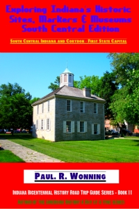
| Exploring Indiana's Historic Sites, Markers & Museums South Central Edition |
Counties - Johnson, Bartholomew, Shelby
Townships - Blue River, German, Jackson
Area - Total - 2.8 sq mi
Elevation - 673 ft
Population (2010) - 4,480
ZIP code - 46124
Area code(s) - 812
Platted in 1832, the origin of Edinburgh's name is not certain. Some ascertain its naming to an early Scotch resident called Alexander Thompson, who named it in honor of his home city. Another legend ascribes the name to early residents who compared the beauty of the area to "Eden." It is located near the confluence of the Big Blue River and Sugar Creek which join to form the Driftwood River. Camp Atterbury, a National Guard training facility, is located west of the town. Edinburgh was platted in 1822 and was incorporated in 1853, Edinburgh lies astride three counties, Johnson, Bartholomew and Shelby. The town lies predominately in Johnson County.
Interested visitors can learn more of the history of Edinburgh at this link.
Highways include:
Indiana State Road 252
US Route 31
Interstate 65
Railroads
Louisville and Indiana rail line
Attractions:
Edinburgh Premium Outlets®
11622 NE Executive Dr
Edinburgh, IN 46124-9133
Blue's Canoe Livery
Heflin Memorial Park
Driftwood Camp
Driftwood State Fishing Area
Azalia State Public Access Site
National Registry Districts
South Walnut Street Historic Distric
Toner Historic District
Edinburgh Commercial Historic District.
Edinburgh
107 S Holland St
P.O. Box 65
Edinburgh, IN 46124
(812) 526-3514 x 1
© Indiana Places 2016
Comments
Post a Comment