Batesville Auto Tour
Start out at Memorial Building on Main. Maps of area inside.
With back to Memorial Building, Sherman House is on the right, across street on other side of George Street.
Drive towards George Street. Turn left. Cross Walnut, Batesville Area Historical Society on left.
Continue on George Street until you reach Mulberry Street
Turn left.
Proceed across RR tracks. Parking for Brum Woods is on the right.
Turn right on Central Ave and then right on Park Avenue.
Liberty Park is on the left.
Continue same direction down Park Ave. Turn left on Pohlman Street
Turn right of Delaware.
The Brum Woods is on the left.
Continue south on Delaware Road about four miles, turn left on 1100 N.
About 1.25 miles to Ertles Winery. You will cross State Road 129
Continue east on 1100 N. About 1.35 miles to "T" with 500 E. Turn left.
Go 3 miles north on 500 E.
The town to the left is Morris, IN. Turn right on Morris Mill Street and go under the underpass for Railroad
Turn left on Indiana State Road 46.
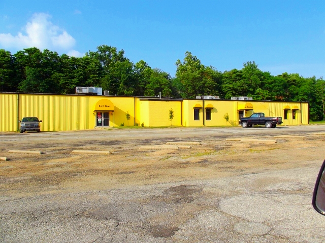
About two miles on right is East Bowl and Lefty’s Pub.
Drive another .34 miles to Weberdings Carving Shop.
Continue one mile to stop light at Indiana State Road 229. Turn Right and cross Interstate 74. A lot of fast food, Hampton Inn and Comfort Inn is out here. Also Kroger, Pamida and other shopping.
Continue on Indiana State Road 229 about 2.25 miles from the Interstate to County Road 700 S (Pocket Road). Turn left.
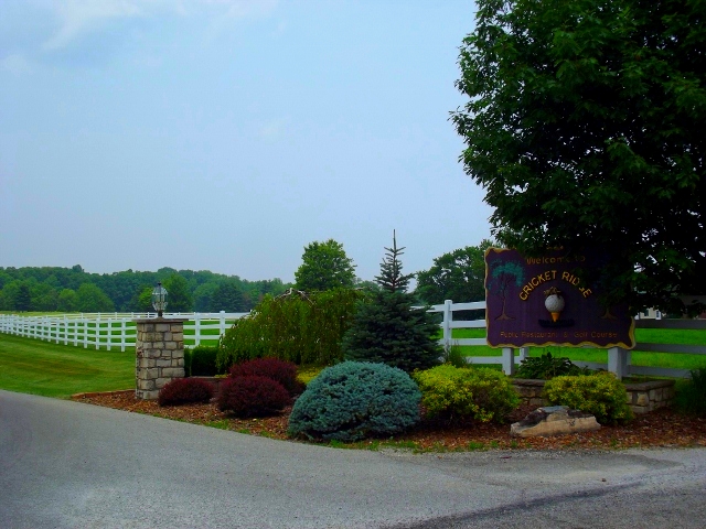
About .5 miles on left is Cricket Ridge Restaurant & Public Golf Course.
Continue on Pocket Road about one mile to "T" with 900W. Turn left.
Continue about .64 miles to Sawmill Road. Turn left.
You are now on Water Street in Oldenburg.
Turn right on the next intersection on Main Street/Indiana State Road 229.
Go around the bend in the highway. Michaela Farm Barn Store is on the right.
Turn left on Vine Street.
The third street is Sycamore Street. Turn left.
Just before the bridge is Hamburg Road. Turn right.
About 1.82 miles you will reach Huntersville Road. Turn left
About 2.6 miles you will reach Indiana State Road 46. You will have crossed the Interstate.
Turn left.
About 1 mile you will reach Indiana State Road 229/Walnut Street. Turn right into Batesville. You will pass the Stonebridge Inn on the right.
Note - Currently Closed
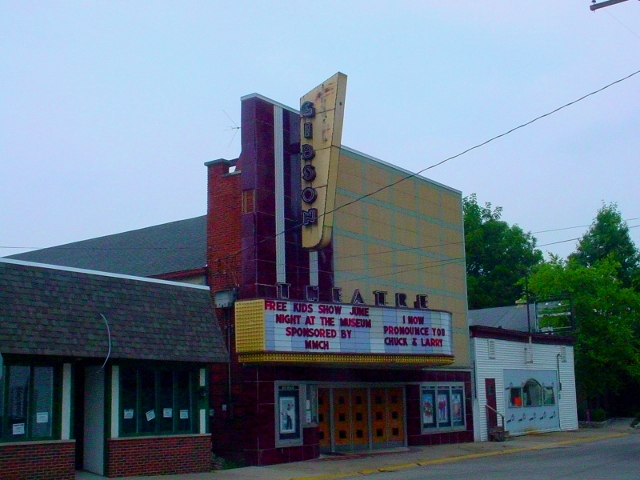
When you reach the four way stop at Boehringer Street, turn left. The next intersection is Main Street. On the left is the Gibson Theatre.
Turn right.
Turn left at the next street, East Pearl. Go through the Shopping Village.
Romweber Marketplace is on the right.
One block and LiL' Charlie's Restaurant & Brewery is on the left.
Turn left on Eastern, then left on Boehringer, then left on Main.
This takes you back to your starting point at the Memorial Building.
Back to Batesville
Back to Ripley County Driving Tours
Start out at Memorial Building on Main. Maps of area inside.
 |
| Batesville Memorial Building |
 | |
| Exploring Indiana's Historic Sites, Markers & Museums South East Edition |
Drive towards George Street. Turn left. Cross Walnut, Batesville Area Historical Society on left.
 |
| Batesville Area Historical Society |
Continue on George Street until you reach Mulberry Street
Turn left.
Proceed across RR tracks. Parking for Brum Woods is on the right.
 |
| Brum Woods |
Turn right on Central Ave and then right on Park Avenue.
Liberty Park is on the left.
 |
| Batesville Liberty Park |
Continue same direction down Park Ave. Turn left on Pohlman Street
Turn right of Delaware.
The Brum Woods is on the left.
Continue south on Delaware Road about four miles, turn left on 1100 N.
About 1.25 miles to Ertles Winery. You will cross State Road 129
 |
| Batesville Auto Tour - Ertle Winery |
Continue east on 1100 N. About 1.35 miles to "T" with 500 E. Turn left.
Go 3 miles north on 500 E.
The town to the left is Morris, IN. Turn right on Morris Mill Street and go under the underpass for Railroad
Turn left on Indiana State Road 46.
About two miles on right is East Bowl and Lefty’s Pub.
 |
| Batesville Auto Tour - Lefty's Pub |
Drive another .34 miles to Weberdings Carving Shop.
 |
| Batesville Auto Tour - Weberdings Carving Shop |
Continue one mile to stop light at Indiana State Road 229. Turn Right and cross Interstate 74. A lot of fast food, Hampton Inn and Comfort Inn is out here. Also Kroger, Pamida and other shopping.
Continue on Indiana State Road 229 about 2.25 miles from the Interstate to County Road 700 S (Pocket Road). Turn left.
About .5 miles on left is Cricket Ridge Restaurant & Public Golf Course.
 |
| Batesville Auto Tour - Cricket Ridge |
Continue on Pocket Road about one mile to "T" with 900W. Turn left.
Continue about .64 miles to Sawmill Road. Turn left.
You are now on Water Street in Oldenburg.
Turn right on the next intersection on Main Street/Indiana State Road 229.
Go around the bend in the highway. Michaela Farm Barn Store is on the right.
 |
| Batesville Auto Tour - Micheala Farms |
Turn left on Vine Street.
The third street is Sycamore Street. Turn left.
Just before the bridge is Hamburg Road. Turn right.
About 1.82 miles you will reach Huntersville Road. Turn left
About 2.6 miles you will reach Indiana State Road 46. You will have crossed the Interstate.
Turn left.
About 1 mile you will reach Indiana State Road 229/Walnut Street. Turn right into Batesville. You will pass the Stonebridge Inn on the right.
Note - Currently Closed
 |
| Batesville Auto Tour - Stonebridge Inn |
When you reach the four way stop at Boehringer Street, turn left. The next intersection is Main Street. On the left is the Gibson Theatre.
 |
| Batesville Auto Tour - Gibson Theatre |
Turn right.
Turn left at the next street, East Pearl. Go through the Shopping Village.
Romweber Marketplace is on the right.
 |
| Batesville Auto Tour - Romweber Marketplace |
One block and LiL' Charlie's Restaurant & Brewery is on the left.
 |
| Batesville Auto Tour - Lil' Charlies |
Turn left on Eastern, then left on Boehringer, then left on Main.
This takes you back to your starting point at the Memorial Building.
Back to Batesville
Back to Ripley County Driving Tours
[…] Batesville Auto Tour […]
ReplyDelete