 |
| Lesko Park - Dearborn County |
 |
| A Visit to Aurora and Lawrenceburg, Indiana |
Area - Total - 307 sq mi
Population - 40,285 - (2000)
Founded 1803
Named for Dr. Henry Dearborn
Dearborn County, Indiana was formed in 1803, thirteen years before Indiana became a state. It was named for Dr. Henry Dearborn, a Revolutionary War hero who was Secretary of War when the county was named.
Dr. Henry Dearborn (Feb. 23, 1751-June 6, 1829)
The son of Simon Dearborn and his wife Sarah Marston, Henry was a native of Hampton, Massachusetts. After attending local schools, Dearborn studied medicine under Dr. Hall Jackson of Portsmouth. After his apprenticeship to Dr. Hall completed he opened a medical practice in 1772. After hostilities broke out in 1776, he recruited a company of militia and served as its captain. He and his company traveled to Bunker and took part in the fight there. His action in the Revolutionary War included the Quebec campaign with Benedict Arnold, winter encampment at Valley Forge, the Battle of Monmouth and many others. President Jefferson appointed him Secretary of War at the beginning of his term in 1801. He served the entirety of Jefferson's term in that capacity.
Transportation
Dearborn County, Indiana is well serviced by State Highways and Interstates. crosses the county on an east west axis, connecting it with Cincinnati, Ohio to the east and Indianapolis to the northwest. US 50 crosses the southern portion of the county, also connecting the county with Cincinnati on the east and Seymour, Bedford and Vincennes to the west. State Road 48 connects Dearborn County with Napoleon, Indiana and State Road 350 connects with US 421 at Osgood, Indiana, both to the west. Indiana State Road 46 links the county from the Indiana State Line on the east to Batesville, Greensburg, Columbus and Bloomington to the west. Indiana State Road 1 links the county to Interstate 74 and US Route 52 to the north. Indiana State Road 56 connects Dearborn County with Paoli, Indiana and Indiana State Road 62 crosses all of southern Indiana and is a part of the Ohio River Scenic Byway. Indiana State Road 148 connects US Route 50 in Aurora with Indiana State Road 48. Indiana State Road 262 connects Dillsboro, Indiana with Rising Sun in Ohio County. Interstate 275 links Dearborn County with Ohio and Kentucky in Greendale at an intersection with Indiana State Road 1 and US 50. Two rail lines cross the county. The CSX Railroad connects Lawrenceburg with Illinois on the southern portion of the county, and the Indiana and Ohio Railroad with Shelbyville to the northeast.
 |
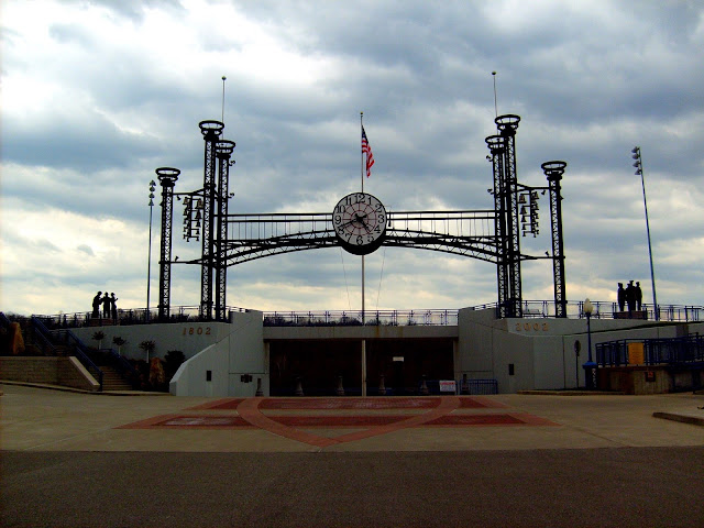
| Lawrenceburg Clock and Tower - Along Ohio River |
The Whitewater River passes through the northeast corner of the county. The Ohio River forms the southern border of the county.
Cities and Towns
Towns of Dearborn County Indiana include Aurora, Bright, Dillsboro, Greendale, Hidden Valley, Lawrenceburg, Moores Hill, Saint Leon and West Harrison.
 |
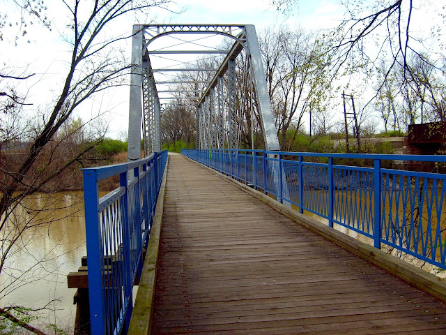
| Dearborn Trail - Bridge |
Dearborn County maintains a nice network of parks located throughout the county. These parks include:
Gladys Russell Wildlife Refuge
Bright Meadows Community Park
Guilford Covered Bridge Park
Rullman Wildlife Refuge
County Farm Park
In addition, hikers will want to walk the Dearborn Trail. this trail follows the Ohio River along its 4.5 mile length. The trail passes through Lawrenceburg, Greendale and Aurora. The trail allows walking access to the historic downtowns of these three lovely riverside towns.
 |
| Gladys Russel Wildlife Refuge |
Dearborn County Parks & Recreation
229 Main Street
Aurora, IN 47001
Phone: 812.496.5425
812.926.1189
parks@dearborncounty.in.gov
For more information on shopping, dining and lodging in Dearborn County, contact:
Dearborn County Visitor Center
320 Walnut Street
Lawrenceburg, IN 47025
812-537-0814
800-322-8198
dearborn@visitsoutheastindiana.com
@indianatreker
@MossyFeetBooks Twitter
@MossyFeetBooks
© Paul Wonning 2016
Comments
Post a Comment