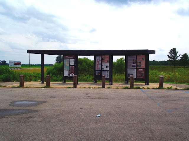
 |
| Stone Bridge Across Big Creek - Near Big Oaks NWR - Michigan Road |
Title of Marker:
Michigan Road
Location:
US 50 and N. Old Michigan Road, 2 miles east of Holton. (Ripley County, Indiana)
Installed by:
Indiana Historical Bureau 1949
Marker ID #:
ID# : 69.1949.1
Marker Text:
Extending from Michigan City to the Ohio River at Madison. Begun by the state in 1832 with funds obtained from sale of land granted by the Potawatomi Indians. Opened northern part of state to settlers.
Michigan Road
Michigan Road is one of the oldest roads in Indiana, built in the early 1800's to connect Madison, Indiana with Michigan City. When the Indiana State Government moved from Corydon, Indiana to Indianapolis, the legislators and governer found themselves in isolation. There were no good roads leading to the new capital city and the White River was not navigable. The sought to rectify this by passing legislation to build the first "superhighway" in the State of Indiana. To accomplish their goal, they needed to negotiate a treaty with the Potawatamie Indian Tribe and clear a vast swath of trees the length of the state.
 |
| Morgan's Trail Tour Stop - Michigan Road |
Madison
The first settlers began populating the site now known as Madison, Indiana around 1806. The town was incorporated in 1809, seven years before Indiana became a state. It's location along the Ohio River caused it to become an important town in the early state's history. In 1836 the Madison & Indianapolis Railroad was completed, connecting the growing city with the new state capital. The state's first major highway was the Michigan Road, commissioned in 1828. Construction began in 1830 and the road was completed in 1837. The Michigan Road, later to become State Road 29, ran from Madison, Indiana to Michigan City on Lake Michigan in the north. It ran through Indianapolis, connecting the state capital to the Ohio River and Lake Michigan. So by the 1840's, Madison was connected to the northern part of the state by road and rail.
Over half of the pioneers settling Indiana passed along this road, and this influx of traffic allowed Madison, Indiana to grow. Competing rail lines caused the railroad to fail, and other routes opened up, causing Madison, Indiana to fall in importance while other cities grew. The population maintained itself from the Civil War until the late 1900's. A program of downtown renewal has resulted in the creation of a vibrant small city along the banks of the Ohio River. The historic downtown has been revitalized, a river walk built along the river and there are exciting events all year, making Madison, Indiana a picturesque and inviting town to visit.
Michigan City
The need for a good harbor on Lake Michigan spurred the developement of Michigan City. A real estate developer named Isaac C. Elston purchased 200 acres along the lakeshore in 1830. He recorded the plat in 1833. Michigan City incorporated in 1836. The completion of the Michigan Road in 1837 connected the growing city with Indianapolis and the Ohio River far to the south.
Treaty With The Potawatomi, 1826
The planned route of the road lay is land still claimed by the Potawatamie Indian Tribe, of which several hundred still lived in the area. To complete the road, the state needed to conclude a treaty with the tribe. This tribe and the state concluded this treaty on October 13, 1836. By terms of the treaty, the tribe conceded a strip of land 100 feet wide through their lands.
Construction of the Road
The legislation called for a road 100 feet wide, with the center thirty feet to be free of stumps. The state contracted out one mile long increments of the road to the lowest bidder. The first fifteen miles of road leading from Madison took over a year to build. The road traveled north from Madison to Napoleon, Indiana and on to Indianpolis.
Indiana State Road 29 followed much of the old route, which today has been superseded by several other highways and roads.
US Route 421 north of Madison follows some of the route of this early highway, and a section along Big Oaks National Wildlife Refuge follows the original route of this early, historic road as it worked its way north. It begins at an intersection with US 421 about 1 mile north of the Jefferson County Line. A Morgan's Raid Marker is just off on the left as the road begins. For the first 5.1 miles Big Oaks National Wildlife Refuge borders the west side of the road.
Michigan Road crosses US Route 50 about 10.5 miles from its inception on US 421.
Michigan Road ends about 8.8 miles north of US 50 at an intersection just south of Napoleon, Indiana. As it turns just near the northern end the original route of the road may be seen along the western edge of the cemetary. From Napoleon, the old road follows US 421 to Logansport. From there State Road 25 followed the original route to Rochester, Indiana. U.S. Route 31 followed the original route from Rochester to South Bend, Indiana. State Road 2 and U.S. Route 20 follow the original road from South Bend to Michigan City.
The Michigan Road was an important early conduit of travel and commerce in the State of Indiana's early history and it still exists in short sections. Another section survives in Decatur and Shelby counties.
Exploring Indiana's Historic Sites, Markers & Museums - South East Edition
|
Follow @MossyFeetBooks
Tweet |
Visit Mossy Feet Books's profile on Pinterest. |
Back to Top
Comments
Post a Comment