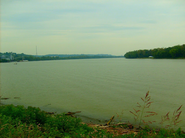
Ohio River
Ohio River in Indiana
Total River Miles - 357
From River Mile 491.34 to River Mile 848
The Ohio River forms the southern border of Posey, Vanderburgh, Warrick, Spencer, Perry, Crawford, Harrison, Floyd, Clark, Jefferson, Switzerland, Ohio and Dearborn counties.
 |
| Ohio River at Lesko Park, Aurora |
 |
| Exploring Indiana's Historic Sites, Markers & Museums South East Edition |
Length - About 7.36 Miles
Parks along the Ohio River
Lesko Ohio River Park
Aurora, Indiana
Dearborn County Towns along the River
Aurora,
Lawrenceburg
Dearborn County Hiking/Biking Trails along the Ohio River
River Trail
Dearborn Trail
Indiana State Highways along the River
Indiana State Road 56
Dearborn County Marinas
BLUE RIBBON MARINA
Ohio River Access
Westside Drive
Aurora
(812)-926-0830
LISCHGKE BOAT HARBOR
Ohio River Access
Judiciary Street
Aurora
(812)-926-0553
Aurora Landing
103 Judiciary Street
Aurora, IN 47001
812-926-1774
Aurora Marina & Campground
11598 State Route 56
Aurora, IN 47001
812-926-2150
Hogan Creek Canoe Ramp
Waterways Park
Aurora, IN 47001
Holiday Hills Resort & Marina
4600 Hartford Pike
Aurora IN, 47001
812-926-2331
Lighthouse Point Yacht Club
11042 State Route 56
Aurora, IN 47001
812-926-4505
Sunset Bay Marina
799 Westside Drive (SR 350)
Aurora, IN 47001
513-266-1117
Tradewinds Marina
605 Green Boulevard
Aurora, IN 47001
812-926-0341
Tanners Public Boat Dock
U.S. 50
Tanners Creek Ln.
Lawrenceburg, Ind.
Water Ways Marina
Moore St
Aurora IN, 47001
812-926-2325
Ohio River In Floyd County
Approximate Length - About 11 miles
Indiana State Road 111 runs the entire length along the Ohio River which may be seen from many points along the highway.
Cities and towns along the Ohio River in Floyd County:
New Albany
Public Access Points to Ohio River in Floyd County
Jaycees Boat Ramp - New Albany
In New Albany on Floyd Street just east of I-64
Middle Creek Ramp
West on Indiana State Road 111 from New Albany to Old River Road. Turn left, the ramp is a short distance down this road.
Back To Top
Ohio River In Clark County
Approximate Length - About 43 miles
Cities and Towns along the River - Jeffersonville, Clarksville, New Albany
Ohio River Boat Ramps - Public Access Sites in Clark County
Charlestown State Park
Falls of the Ohio State Park
New Albany's Waterfront Park
George Rogers Clark Home Site
Ohio River Cannelton Pool at the west end of Harrison Ave. in Clarksville
Riverfront Park on Water St. in New Albany
Middle Cr. Ramp, follow SR 111 SW from New Albany to Old River Rd, then E and S for 3 mi. to ramp
Parks along the Ohio River
Charlestown State Park
Falls of the Ohio State Park
Ohio River In Jefferson County
Approximate Length - 23 Miles
Highways along the River - Indiana State Road 56
Cities and Towns along the River - Madison, Hanover
Ohio River In Hanover
Hanover College is located along the high bank of the Ohio River and has a landmark on campus known locally as the "Point." This is the only place along the Ohio River from which three bends can be seen. It is a spectatcular sight. Hanover Beach, located on Hanover Beach Road, is located on the Ohio River and is a popular place for swimming, boating and fishing.
Madison
Madison has found a way to celebrate its location along the Ohio River. Lamplighter Riverfront Park, Madison’s Heritage Trail, and the Madison Public Boat Ramp all make use of the river to accentuate the city's beauty. Stunning views of the Ohio River all along the Madison Heritage Trail in Lamplighter Riverfront park allow the visitor to relax while enjoying the beauty of the river.
Nearby Clifty Falls State Park Inn has a stunning panorama of the river from its Riverside rooms and there is a sun room that guests may read in while overlooking the river. Indiana State Road 56 east of Madison offers a relaxing drive during most of which the River is visible from the road. It is part of the Ohio River Scenic Byway.
Back To Top
Ohio River In Switzerland County
Length -
Switzerland County Towns along the River
Vevay
Patriot
Parks along the Ohio River
Jennings Park – Ohio River Park
Oogle Park
Switzerland County Ohio River Boat Ramps - Public Access Sites
Paul Ogle River Front Park
Ferry Street Vevay, IN
The Paul Ogle River Front Park has a boat ramp with a portable dock during warm weather, camping along the Ohio River, picnic area, RV camping and ball fields. Paul Ogle Riverfront Park is located near the downtown of Vevay .
Bryant’s Creek Boat Ramp
Just off of Indiana State Road 156
Between Patriot and Florence, Indiana
Patriot Boat Ramp
2nd Street in Patriot
Ohio River in Ohio County
Length - Approximately 11 miles
The Ohio River forms the eastern border of Ohio County. There are no bridges across the river to Kentucky.
Marinas
MAGIC VALLEY BOAT LODGE Ohio River Access R.R. 2 Rising Sun (812)-438-3586
RISING SUN MARINA Ohio River Access First and Front St. Rising Sun (812)-438-3225
Towns along the Ohio River in Ohio County
Rising Sun
Highways along the Ohio River in Ohio County
IndianaState Road 156
Indiana State Road 56
These highways together make up the Ohio River Scenic Byway in Ohio County
[…] Ohio River […]
ReplyDelete[…] Indiana has a history as a history as an important river port on the Ohio River. The town saw some settlement as early as 1796. An engagement of the Revolutionary War took place […]
ReplyDelete[…] failed to grow during the first years of its existance, due mainly to periodic inundation by Ohio River floods, the Flood of 1937 being the worst. After World War II, the town began a period of growth […]
ReplyDelete